Research
|
Resource
Achievements in Recent Years
Flood Risk Analysis and Loss Assessment Model Establishment
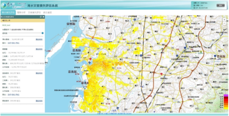
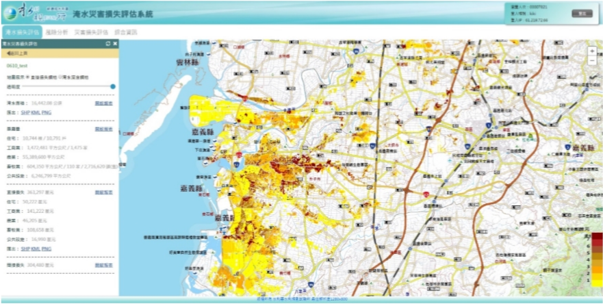
Flood Risk Analysis and Loss Assessment Model Establishment The AERC has established a flood loss estimation and risk assessment system. The system is capable of analyzing the losses for each flood or rainstorm to provide immediate information on disaster prevention and reduction. It is also possible to conduct a drainage planning risk analysis before the disaster to select the most effective planning project.
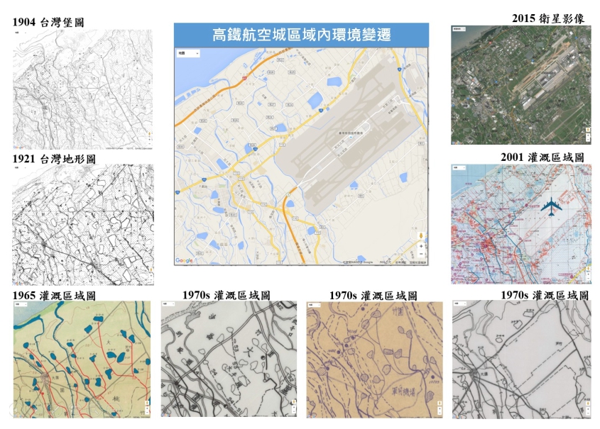
Digital Collection Applications on Historical Map Materials for Irrigation in Agriculture
Digital Collection Applications on Historical Map Materials for Irrigation in Agriculture The AERC has collected paper maps of the Irrigation Associations and established a historical map materials spatial retrieval system, which not only improves the searching efficiency, but also can be applied to the identification of members, the clarification of the subsidy application for irrigation area, proof for the irrigation disputes or the land acquisition subsidy, potential arable land distribution outside the irrigation district, exploration of ancient water courses or water sources, references for construction renewal, investigation of ancient monuments or examination of ancient locations.
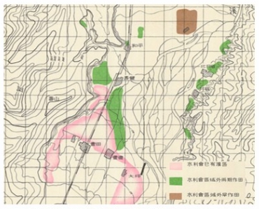
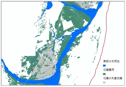
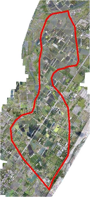
Application demonstration of potential arable land distribution outside irrigation district
Application of Unmanned Aerial Vehicle(UAV) in Agriculture and Water Resources
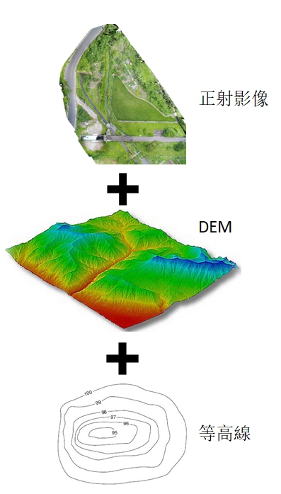
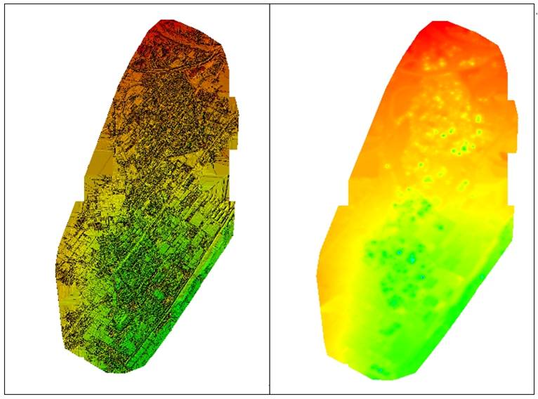
Produce a high-resolution true-orthoimage by UAS(Unmanned Aircraft Systems) for on-site exploration can quickly collect local terrain and appearance for future subsequent plans to evaluate water delivery routes and its requirements. By highly flexibility of nowadays drone, it can quickly captures images and draws 3D model with complete spatial information to facilitate querying coordinates/elevation or drawing canal sections profile. Through the 3D model, can directly understand the terrain and enhance the visualization.
Introduction to This Group
Please see the service content and contact information of this group:Introduction of Resource Group
Achievements Over the Years
- Investigation and discussion on reliable water quantity and water use in irrigation system
- Setting and application of agricultural meteorological observatory
- Research on improvement of water supply capacity by improving irrigation facilities such as water storage and water intake in irrigation association
- Compensation cost analysis for transferring irrigation water from the Chu-don canal of Taiwan Hsinchu irrigation association
- Discussion on the allocation and utilization of irrigation water and related issues for former Luye canal
- Effects on water content by soil surface temperature
- Study on groundwater recharge by recession paddy field
- Water quality monitoring and management system for the Shihmen reservoir
- Inventory of total amount of agricultural irrigation water in Taiwan
- Related projects of “TAIWAN WATER CONSERVANCY”
- Compensation cost analysis for transferring irrigation water from the Ba-bao irrigation canal of Taichung irrigation association
- Survey and investigation of Chianan plain for groundwater resource
- Investigation and mapping the groundwater well by GPS over Changhua and Yunlin association's irrigation area
- On the rainfall and runoff of Tsengwen reservoir watershed from typhoon Herb
- Study on the efficient management and the counter measures of water shortage for irrigation operation
- Study on the most rational irrigation requirement over Shihmen Reservoir Irrigation Area
Outcome Poster