Research
Achievements in Recent Years
Farmland Water Conservancy Project Management
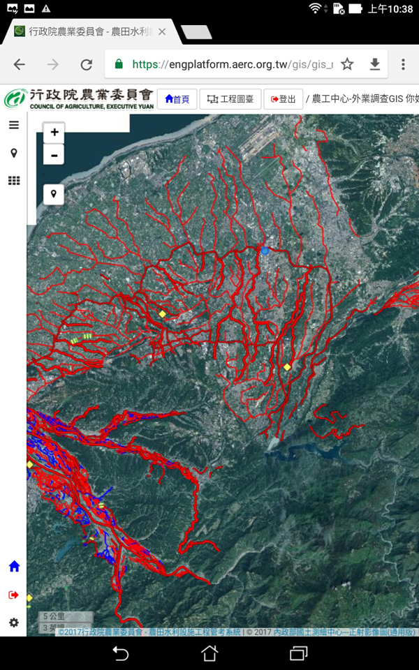
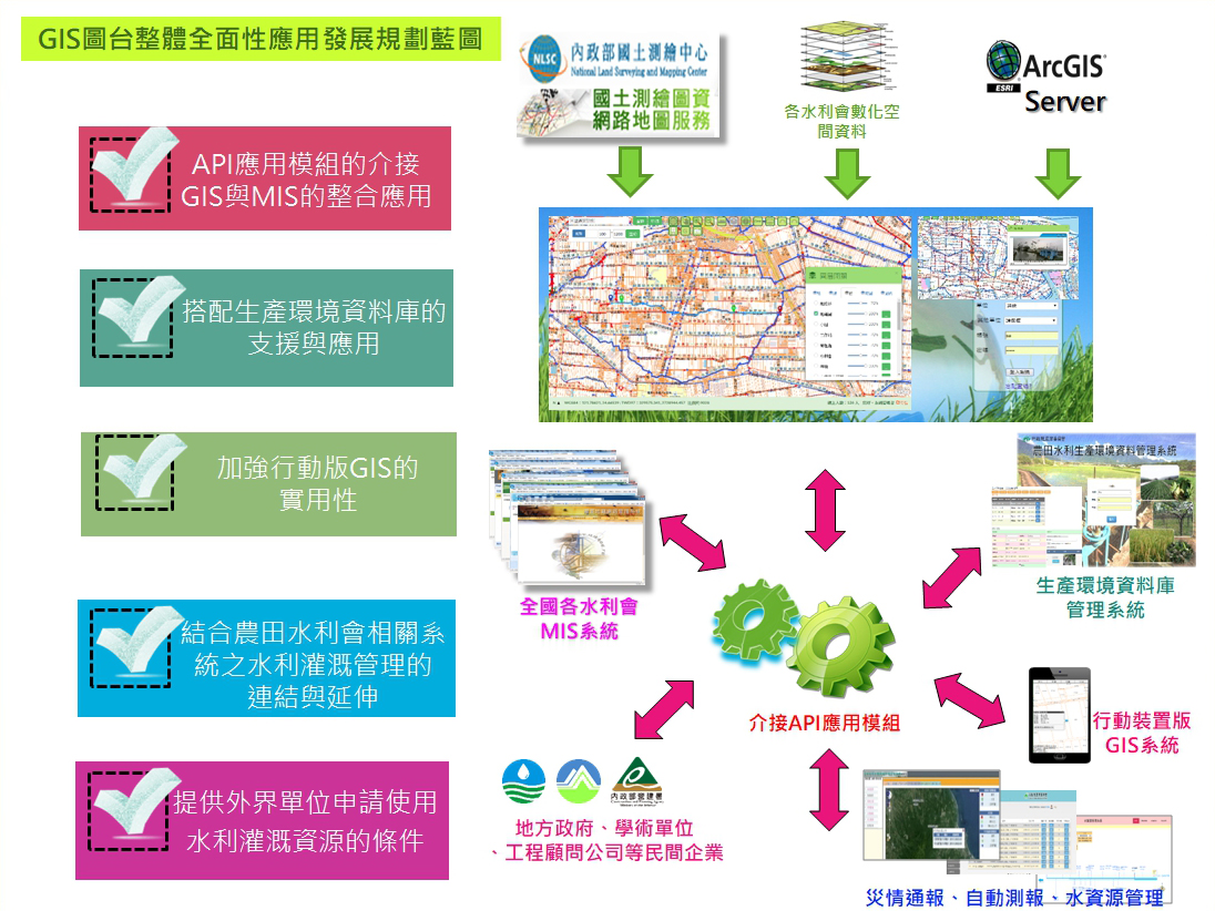
The system combines information management system (MIS) and geographic information system (GIS) to conduct farmland water conservancy facilities engineering management, and uses geographic information system (GIS) and remote sensing (RS) maps to manage the project location of farmland water conservancy projects. In addition to the establishment of the location and engineering location query mechanism in the system, engineering cases are presented and output in a common numerical format (shapefile), which facilitates the integration and statistical analysis of managers on other computers or mobile devices, and promotes farmland water conservancy. Facility management is more convenient and efficient.
GIS Development and Application
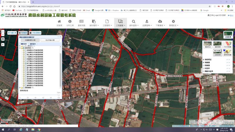
GIS development and application covers from irrigation management and production environment databases for farmlands, to engineering and administrative information systems, integration of the GIS portal operation, property positioning, map inquiry, GIS publishing and layering, drawing and management application tools, the overall management of irrigation and performance enhancement on behalf of the Irrigation Association, the development of a mobile website and smartphone applications, a mobile-device based on-site inspection inquiry system such as a layering of farmland mapping data to accelerate the irrigation land survey process.
In addition, when a land set-aside application is accepted, the on-site inspection is now accelerated through the GIS application. Such use has tremendously enhanced efficiency and irrigation management performance.
Automated Reporting, Hydraulic Engineering GIS
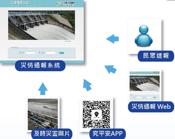
Regarding automated reporting, hydraulic engineering and natural disaster prevention, it includes the establishment of an automated reporting system for each discharge/pump station at the farmlands, video streaming platform consolidation for timely irrigation and ditch water level observation. Water gates can be controlled remotely in reaction to irrigation and flood alerts, plus timely on-site reports and image uploads through the Disaster Information Notification (DIN) can provide the decision-maker with the most updated information.
Natural Disaster Prevention
For flood rescue, with the GIS platform of DIN, the re-marking of land to damaged irrigation channels helps emergent water diversion within a minimum time. This can save up to hundreds of millions of dollars invested. Regarding flood prevention planning, the flood damage evaluation system is set to analyze the damage from each typhoon or heavy rain that causes flooding. Critical information becomes available for timely prevention and rescue tasks. Such technology applies to find the best solution of water discharge risk analysis planning.
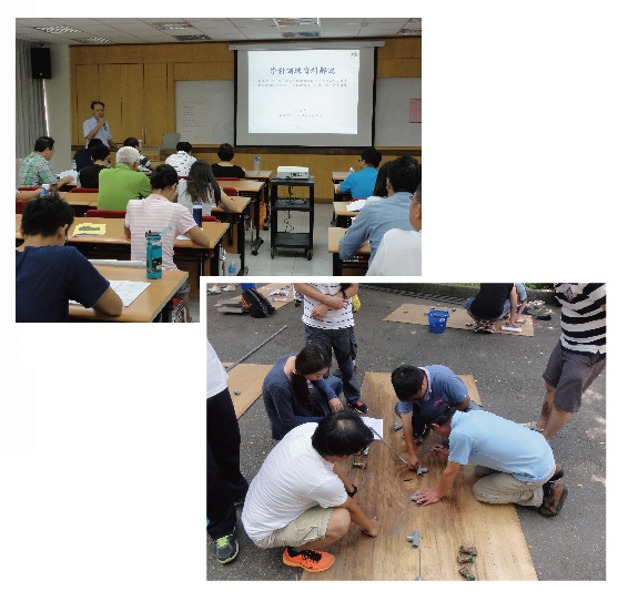
Water-Saving Irrigation Training and Facilitation
On water-saving irrigation training and facilitation, pipe irrigation training is conducted on the request of the Council of Agriculture and farmer’s associations. Solutions are embedded to meet actual farmland status and enhanced irrigation efficiency.
According to statistics, since the beginning of the pipe irrigation program in 1983, the national pipe irrigation area, facilitated by the Center, local Irrigation Associations and Farmer’s Association, has covered more than 50 thousand hectares, the beneficiary farmers more than 70 thousand. In average, the irrigation water saved by 5,000 tons/hectare, and equivalent to 250 million tons/year.
Aquaculture Engineering
For Aquaculture Engineering, so far 47 production zones across 10 cities/counties have upgraded their facilities; 5 concentration areas, the sea water/fresh water supply/discharge system and the construction of roads have successfully solved most flooding situations in the fish raising zone. A stable supply of sea water has also reduced groundwater usage and enhanced better resource sustainability while taking good care of fish farmers’ livelihood. Categorized under the “Comprehensive Management Plan of the River Basin”, the drainage of 7 production zones and the fish farm concentration area are connected to the drainage system to accommodate flood disasters. Rescue training and flood measurement are enhanced to elevate local disaster contingency capabilities.
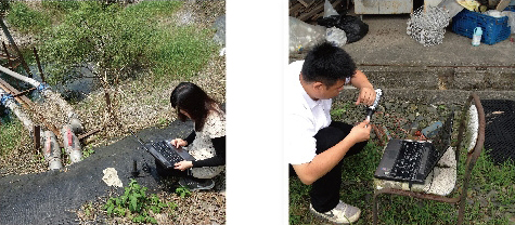
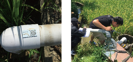
Groundwater Observation and Management
Right with regards to groundwater observation and management, though groundwater benefits from a good quality, stable supply, constant temperature and is relatively cheaper, when over pumped, or the pump amount miscalculated, it can cause unbalanced groundwater access, exhausting resources and increasing land subsidence. to reinforce the well access and groundwater efficiency and including land subsidence solutions and groundwater conservation, the Center has recently endeavored to create the groundwater conservation program with updated management methods: inventory of target wells, device ID-labeling, certain fish farm area groundwater monitoring and safe water level estimates, equilibrium’s analysis of plant usage and discharge, and the future smart water meter measurement control demonstration.
Agricultural Irrigation Water Control
AERC has developed data collection and transmission over cloud technology and IoT to control irrigation water; the required level of water in the irrigation area is estimated via Remote Sensing to cut down on excessive water supply and achieve more precise water estimation.
Enhance Capability of Environmental Analysis laboratory
From enhanced environmental analysis laboratory for waterbody soil sampling and examination, to agricultural products and food examination, and even border inspection, traceability mechanisms and the agricultural product label certification establishment, the Center cares and contributes to food safety.
Expand Irrigation Area
To increase irrigation coverage, water-shortage areas are developed with farm ponds, rainwater harvesting, and recycled water utilization. Conserved pipe irrigation development with central government’s “Big Barn” project: Actual status-based solutions, an increase of current pipe irrigation demo locations into zones. The goal is the optimization of government investment results and increased quality irrigation coverage.

GIS Application
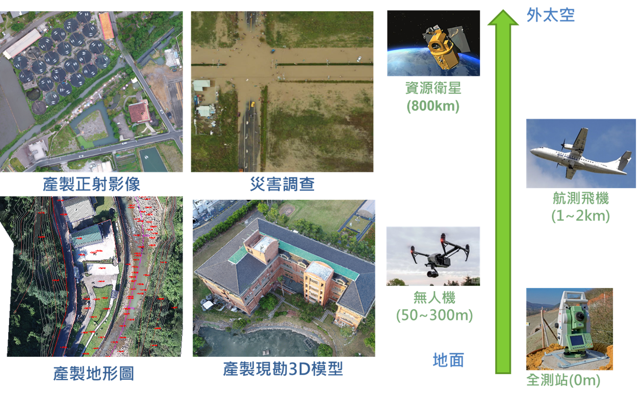
Regarding GIS application, the comprehensive adoption of the system application module into the local Irrigation Associations’ MIS system, public/private sections’ systems, and Production Environment Database, and the automated reporting system have been completed with an improved mobile page for GIS. In recent years, the environmental impact brought about by climate change has elevated the priority of quick surface information collection and analysis. UAVs (Unmanned Aerial Vehicle), popular now due to their time-efficient data collection, will be used to collect crop surveys, irrigation and disaster prevention, as well as for the later production of 3D models of the hydraulic facilities.
Environmental Measurement and Inspection and Technology Assistance
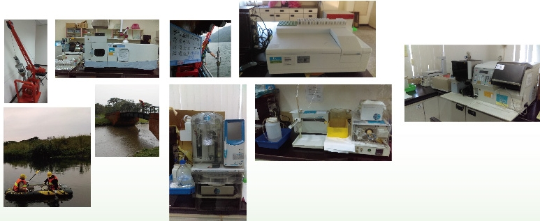

As for environmental measurement, inspection and technology assistance, professional analysis on public/private environmental samples of surface water, groundwater, soil, sediment, and crops, are performed by EPA certified environmental analysis laboratories. For example, the Center has been monitoring deep groundwater as well as the status of the Shimen Reservoir, Baoshan’s Second Reservoir and the Deji Reservoir for a number of years. This is to certify the water resource for public use. The comprehensive water quality database and its correlations with environment change not only protects public water safety, but also ensure water sustainability.